Entire State
A Compleat Map of North-Carolina, 1770
First Actual Survey of North Carolina, 1808
Map of the Cherokee Nation, 1884
North Carolina State Highway Map, 1936
Alamance County
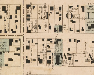
Map of Alamance County with Property Owners, 1893
Alamance County Highway Map, 1938
Alexander County
Alexander County Highway Map, 1938
Alleghany County
Alleghany County Soil Survey, 1915
Alleghany County Highway Map, 1968
Anson County
Gray's New Map of Wadesboro, Anson County, North Carolina, 1882
Anson County Road Map, 1930
Ashe County
Ashe County Soil Survey, 1912
Avery County
Town site of Linville
Avery County Highway Map, 1938
Beaufort County
Beaufort County Soil Survey, 1917
Beaufort County Road Map, 1936
Bertie County
Bertie County Soil Survey, 1918
Bladen County
Bladen County Soil Survey, 1914
Bladen County Highway Map, 1968
Brunswick County
Brunswick County Map, 1910
Brunswick County Soil Survey, 1932
Buncombe County
Map of Asheville, ca. 1890s
Buncombe County Soil Survey, 1920
Map of Asheville, 1921
Burke County
Burke County Soil Survey, 1926
Burke County Highway Map, 1938
Cabarrus County
Cabarrus County Soil Survey, 1910
Caldwell County
Caldwell County Soil Survey, 1917
Caldwell County School Map, 1924
Camden County
Map of Elizabeth City, 1881
Soil Survey of Camden and Currituck Counties, 1923
Carteret County
Carteret County Soil Survey, 1935
Beaufort Inlet Coast Survey, 1944
Caswell County
Caswell County School Districts, 1868
Caswell County Soil Survey, 1908
Catawba County
Map of Catawba County, 1886
Catawba County Highway Map, 1938
Chatham County
Chatham County Soil Survey, 1933
Plan for Jordan Lake, 1964
Cherokee County
Cherokee County Soil Survey, 1921
Chowan County
Chowan County Soil Survey, 1906
Clay County
Clay County Soil Survey, 1935
Cleveland County
Cleveland County Soil Survey, 1918
Columbus County
Columbus County Soil Survey, 1915
Craven County
A Plan of the Town of New Bern, 1822
A plan of the city of Newbern, 1875
Craven County Soil Survey, 1904
Craven County Soil Survey, 1929
Cumberland County
Fayetteville, 1825
Cumberland County Soil Survey, 1922
Currituck County
Coast Survey of Albemarle Sound, 1910
From Cape Henry to Currituck Beach, 1913
Coast Survey of Albemarle Sound, 1913
Soil Survey of Camden and Currituck Counties, 1923
Dare County
Coast Survey of Albemarle Sound, 1910
Coast Survey of Albemarle Sound, 1913
Dare County Highway Map, 1938
Davidson County
Davidson County Soil Survey, 1915
Thomasville Zone Map, 1930
Davie County
Davie County Soil Survey, 1927
Mocksville Enterprise Map of Davie County, 1936
Duplin County
Duplin County Soil Survey, 1905
Town of Wallace, 1930
Durham County
Plan of the City of Durham, N.C., circa 1887
Map of Durham County, 1920
Durham County Soil Survey, 1920
Plan for Jordan Lake, 1964
Edgecombe County
Map of Edgecombe County, 1905
Town of Tarboro, n.d.
Forsyth County
Forsyth County Soil Survey, 1913
Map of Winston-Salem, ca. 1920
City of Winston-Salem Zone Map, 1930
Franklin County
Gray's New Map of Louisburg, Franklin County, North Carolina, 1882
Map of Franklin County, 1907
Gaston County
Gaston County Soil Survey, 1909
Gates County
Gates County Soil Survey, 1929
Gates County Highway Map, 1968
Graham County
Graham County Highway Map, 1938
Granville County
Gray's New Map of Oxford, Granville County, North Carolina, 1882
Granville County Road Map, 1936
Greene County
Greene County Soil Survey, 1924
Guilford County
Guilford County Soil Survey, 1920
Guilford County, North Carolina (Highway maintenance map), 1968
Halifax County
Halifax County Soil Survey, 1916
Halifax County Highway Map, 1968
Harnett County
Harnett County Soil Survey, 1916
Harnett County Highway Map, 1938
Haywood County
Haywood County Highway Map, 1938
Henderson County
Henderson County Soil Survey, 1907
Main highways, mountain peaks and streams of Henderson County , 1918
Hertford County
Hertford County Soil Survey, 1916
Hertford County Highway Map, 1968
Hoke County
Hoke County Soil Survey, 1918
Hoke County Highway Map, 1938
Hyde County
Hyde County Highway Map, 1938
Iredell County
Iredell County Highway Map, 1938
|
Jackson County
Jackson County Highway Map, 1938
Jackson County Highway Map, 1968
Johnston County
Battle of Bentonville, N.C., circa 1891-1895
Johnston County Soil Survey, 1911
Jones County
Jones County Soil Survey, 1934
Lee County
Lee County Highway Map, 1938
Lenoir County
Lenoir County Soil Survey, 1927
Lincoln County
Lincoln County Soil Survey, 1914
Macon County
Macon County Soil Survey, 1933
Madison County
Madison County Soil Survey, 1927
Martin County
Martin County Highway Map, 1938
McDowell County
McDowell County Highway Map, 1938
Mecklenburg County
Map of Charlotte, 1877
Mecklenburg County Soil Survey, 1910
Map of Mecklenburg County, 1911
Mecklenburg County Highway Map,1968
Mitchell County
Town site of Linville
Mitchell and Yancey Counties Highway Map, 1938
Mitchell County Highway Map, 1967
Montgomery County
Rural Delivery Routes, Montgomery County, circa 1910-1919
Moore County
Moore County Soil Survey, 1919
Pinehurst Country Club, 1922
Nash County
Nash County, 1919
New Hanover County
Map showing the entrenchments around Wilmington, 1863
Central Part of Wilmington, circa 1882
Map of New Hanover County, 1886
New Hanover County Soil Survey, 1906
Northampton County
Northampton County Soil Survey, 1925
Northampton County Highway Map, 1938
Onslow County
Onslow County Soil Survey, 1921
Onslow County Highway Map, 1938
Orange County
Orange County Soil Survey, 1918
Topography, Chapel Hill and Vicinity, 1918
Map of the University of North Carolina at Chapel Hill, 1933
Plan for Jordan Lake, 1964
Pamlico County
Pamlico County Soil Survey, 1934
Pasquotank County
Map of Elizabeth City, 1881
Pasquotank and Perquimans Counties Soil Survey, 1905
Pender County
Proposed Farm City, Pender County, 1922
Pender County Highway Map, 1938
Perquimans County
Pasquotank and Perquimans Counties Soil Survey, 1905
Person County
Person County Rural Delivery Map, Circa 1910-1919
Person County Soil Survey, 1928
Pitt County
Pitt County Soil Survey, 1909
Polk County
Polk County Soil Survey, 1923
Randolph County
Randolph County Soil Survey, 1915
Richmond County
Richmond County Soil Survey, 1911
Robeson County
Robeson County Soil Survey, 1908
Rockingham County
Rockingham County Highway Map, 1938
Rowan County
Rowan County Soil Survey, 1914
Rutherford County
Rutherford County Soil Survey, 1914
Sampson County
Sampson County Soil Survey, 1924
Scotland County
Scotland County Soil Survey, 1909
Stanly County
Stanly County Soil Survey, 1916
Stokes County
Stokes County Soil Survey, 1934
Surry County
Map of Surry County with Property Owners, 1921
Surry County Soil Survey, 1932
Swain County
Swain County Highway Map, 1938
Transylvania County
Transylvania County Soil Survey, 1906
Tyrrell County
Tyrrell County Soil Survey, 1920
Union County
Union County School Districts, 1858
Gray's New Map of Monroe, ca. 1882
Union County Soil Survey, 1914
Vance County
Vance County Soil Survey, 1918
Wake County
Plan of Raleigh, 1867
Wake County Soil Survey, 1914
Map of Raleigh, 1914
Raleigh, N.C. precinct map, 1935
Plan for Jordan Lake, 1964
Warren County
Map of Warren County, 1874
Washington County
Washington County Soil Survey, 1932
Watauga County
Watauga County Soil Survey, 1928
Wayne County
Wayne County Soil Survey, 1916
Wilkes County
Wilkes County Soil Survey, 1918
Wilson County
Wilson County Soil Survey, 1925
Yadkin County
Yadkin County Soil Survey, 1924
Yancey County
Mitchell and Yancey Counties Highway Map, 1938
Yancey County Highway Map, 1967
|