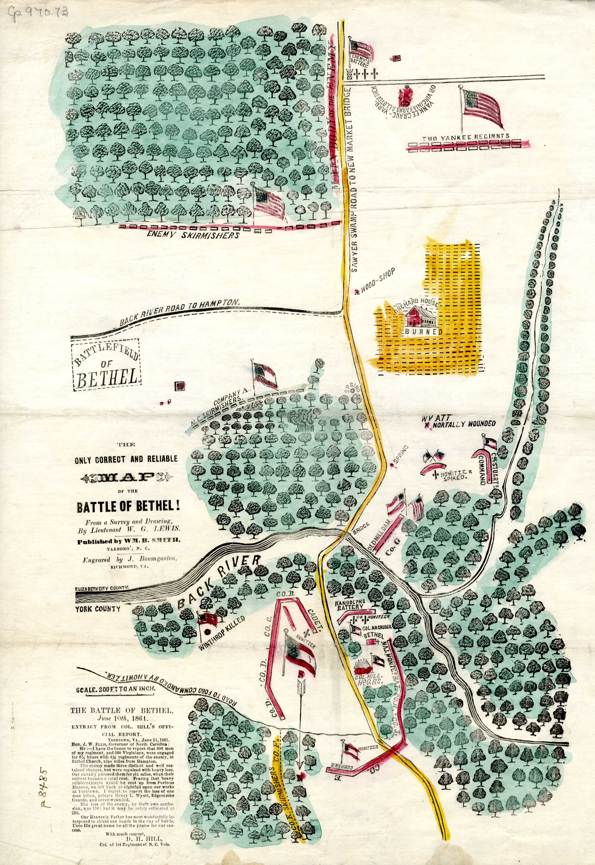
Item description: Map of the Battle of Bethel (Va.), a battle fought on 10 June 1861. Many historians consider the Battle of Bethel (also known as the Battle of Bethel Church, or Big Bethel) to be the first land battle of the American Civil War. This map was drawn by William Gaston Lewis, a lieutenant and civil engineer with the “Edgecombe Guards” (Company A of the 1st North Carolina), who participated in the battle. The map was later printed, hand-tinted, and sold as a souvenir – together with a short 11 June 1861 report written by Colonel D.H. Hill.
[Click here to read more about the Battle of Bethel, from the North Carolina Collection’s online series, “This Month in North Carolina History.”]
Item citation: “The Only Correct and Reliable Map of the Battle of Bethel!: From a Survey and Drawing,” catalog number Cm912p 1861L, from the North Carolina Collection, Wilson Library, University of North Carolina at Chapel Hill.


