Browse Maps by Location
The maps in the North Carolina Maps project range in coverage from small islands to all of North America. To help with navigating through the maps, there are several options for browsing the collection by location. Users can browse maps of specific counties, maps that show regions within North Carolina, and maps that show the entire state. There is also a full list of the primary locations shown on maps in the collection. Please see the page Tips for Finding Maps by Location for suggestions and examples.
Browse Maps by County
Please note that this list does not include every map that covers a particular county; these results include only those areas that are the primary subject of an individual map, or are covered in detail in inset maps. Wake County, for instance, is also shown on maps depicting the Piedmont Region as well as on those depicting the entire state. For broader coverage, visit Browse Maps by Region or Browse Statewide Maps.

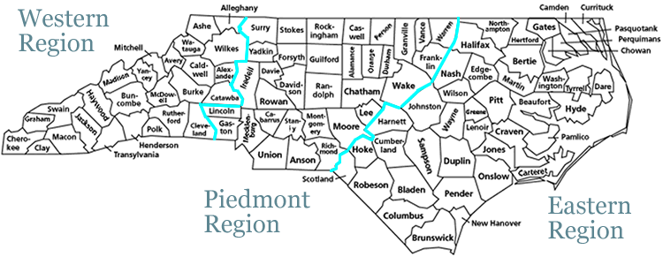
Browse Maps by Region
Use the map below to browse by maps showing areas within one of the three primary geographic regions in North Carolina. Clicking on a region will retrieve maps showing the general area, as well as maps showing counties and smaller areas within that region. For a narrower search, see the Browse by County map at the top of this page. Users can also browse all maps showing the entire state of North Carolina in the online collection.